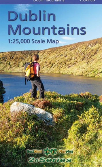
Dublin Mountains Map
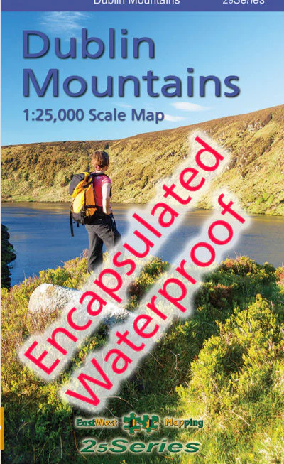
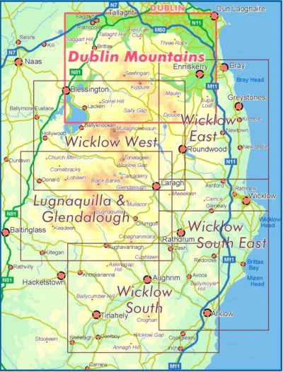
Definitive detailed map from our 25Series of Wicklow at 1:25,000 scale covering from Tallaght to Sally Gap and Blessington to Enniskerry. Covers all the Dublin Mountains including the full Dublin Mountains Way walking route plus other local waymarked trails. First published in 2009, this is a completely new and detailed map replacing the previous 1:30,000 scale maps. We have conducted considerable research into local sites & placenames and much information is recorded on this map. Printed on good quality Progeo 90gsm map paper. The map sheet measures 1125mm x 820mm, covering 550 sq kilometres, and is folded down to 125mm x 205mm. Read care instructions in FAQ.
1:25,000 Scale : 1 centimetre on the map = 250 metres on the ground. Contour Interval : 5 metres.
Published April 2021. This 1:25,000 scale map replaces the 1:30,000 map published in 2009, 2013 & 2019.
| WEIGHT | 0.1 kg |
|---|---|
| DIMENSIONS | 20 × 12.5 × .5 cm |
Original: $22.00
-65%$22.00
$7.70More Images
Dublin Mountains Map
Definitive detailed map from our 25Series of Wicklow at 1:25,000 scale covering from Tallaght to Sally Gap and Blessington to Enniskerry. Covers all the Dublin Mountains including the full Dublin Mountains Way walking route plus other local waymarked trails. First published in 2009, this is a completely new and detailed map replacing the previous 1:30,000 scale maps. We have conducted considerable research into local sites & placenames and much information is recorded on this map. Printed on good quality Progeo 90gsm map paper. The map sheet measures 1125mm x 820mm, covering 550 sq kilometres, and is folded down to 125mm x 205mm. Read care instructions in FAQ.
1:25,000 Scale : 1 centimetre on the map = 250 metres on the ground. Contour Interval : 5 metres.
Published April 2021. This 1:25,000 scale map replaces the 1:30,000 map published in 2009, 2013 & 2019.
| WEIGHT | 0.1 kg |
|---|---|
| DIMENSIONS | 20 × 12.5 × .5 cm |
Product Information
Product Information
Shipping & Returns
Shipping & Returns
Description
Definitive detailed map from our 25Series of Wicklow at 1:25,000 scale covering from Tallaght to Sally Gap and Blessington to Enniskerry. Covers all the Dublin Mountains including the full Dublin Mountains Way walking route plus other local waymarked trails. First published in 2009, this is a completely new and detailed map replacing the previous 1:30,000 scale maps. We have conducted considerable research into local sites & placenames and much information is recorded on this map. Printed on good quality Progeo 90gsm map paper. The map sheet measures 1125mm x 820mm, covering 550 sq kilometres, and is folded down to 125mm x 205mm. Read care instructions in FAQ.
1:25,000 Scale : 1 centimetre on the map = 250 metres on the ground. Contour Interval : 5 metres.
Published April 2021. This 1:25,000 scale map replaces the 1:30,000 map published in 2009, 2013 & 2019.
| WEIGHT | 0.1 kg |
|---|---|
| DIMENSIONS | 20 × 12.5 × .5 cm |